 Island Park, Idaho" fetchpriority="high" decoding="async">
Hiking in Island Park country
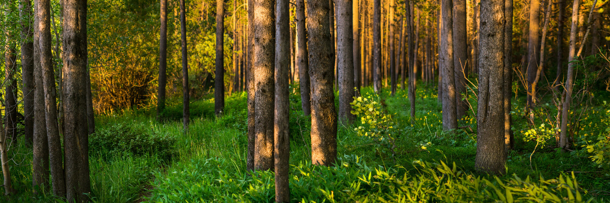
Island Park hiking is mostly in the Caribou-Targhee National Forest, on a mix of Forest Service trails, state park trails (Harriman), and short interpretive loops. The terrain is forested caldera floor and mountainous flank — long, mostly flat walks in the bowl, steeper climbs in the Centennials and Sawtelle area.
The hiking season is short. Snow lingers above 7,500 feet into early July most years and starts returning in mid-October. The reliable window is mid-June through early October. Above 8,000 feet, July 15 to September 15 is the typical snow-free corridor.
Below: ten trails that cover the range of difficulty and the major access points. Distances and conditions are from AllTrails and Caribou-Targhee NF published data; verify trailhead conditions before going.
Ten trails worth knowing
1. Coffee Pot Rapids Trail (easy – moderate, 4.3 miles RT)
The most popular hike in Island Park, on AllTrails. The trail follows the Henry’s Fork down to Coffee Pot Rapids, where the river drops through a boulder field. Wildlife viewing is excellent — the canyon holds otters, ospreys, and big trout. Average completion time is about 1 hour 19 minutes for a moderately paced hiker. The rapids themselves are dangerous to swim or wade — admire from the bank. (AllTrails)
2. Big Springs Trail (easy, 0.5 mile loop with boardwalk)
The interpretive loop at Big Springs — paved and boardwalk-accessible. You walk to the source of the Henry’s Fork, see 120 million gallons of water emerging from the ground every day, and watch enormous wild rainbow trout in the closed water below the spring. Combine with Johnny Sack’s Cabin (just up the trail). 30–45 minutes including the cabin.
3. Mesa Falls boardwalks (easy, 0.5 mile)
Universally accessible pathways and stairs leading to viewing platforms at the brink of Upper Mesa Falls (114 feet). Plus a quarter-mile walk to the overlook for Lower Mesa Falls (65 feet). See the Mesa Falls Scenic Byway guide for fee and hours.
4. Buffalo River Loop (easy – moderate, 2.5 miles)
A loop through forest along the Buffalo River, a Henry’s Fork tributary. Good wildlife viewing — moose are common in the willows. Trail is gentle, popular year-round including in winter for snowshoeing. Trailhead near Big Springs.
5. Harriman State Park trails (easy, multiple distances)
22 miles of trail network through the 11,000-acre Harriman wildlife refuge. Mostly flat. Trumpeter swans, sandhill cranes, moose, elk. Best for birding and easy walking. The Ranch Loop is 3.5 miles. The full periphery loop is closer to 8 miles. (Idaho Parks & Rec)
6. Sawtelle Peak trail (moderate – strenuous, varies)
From the upper reaches of Sawtelle Peak Road, a trail climbs through sub-alpine forest to the 9,866-foot summit area. The road itself is drivable to within 1–2 miles of the summit, so this is a shorter hike than the elevation suggests. Snow blocks the trail until mid-July most years — later in heavy-snow years. Stunning views in 360 degrees from the top: Tetons, Centennials, Yellowstone Plateau.
7. Targhee Pass / Continental Divide Trail (moderate – long)
The Continental Divide National Scenic Trail passes through this area on its way from Mexico to Canada. Day-hikeable sections from Targhee Pass on the Idaho-Montana border. High-country, exposed, no water reliable. For experienced hikers only.
8. Mesa Falls River Trail (moderate, 4 miles RT)
Connects Upper to Lower Mesa Falls along the river canyon. More dramatic than the boardwalk view at the falls themselves. The trail traverses cliffs and forest. Bear spray recommended — this canyon has black bear activity.
9. Sheep Falls Trail (moderate, 4.5 miles RT)
A lesser-known hike to a small but striking waterfall on Henry's Fork-adjacent tributary terrain. Quieter than Mesa Falls; locals’ favorite. Trailhead off Mesa Falls Scenic Byway.
10. Lionhead Trail (strenuous, 7–10 miles RT)
Across the Montana border in the Custer Gallatin National Forest. Climbs to the prominent Lionhead Peak above Henry's Lake. Best mid-July to mid-September. High elevation, technical in spots near the top.
Practical hiking info
Bear safety
Black bears are common throughout the Caribou-Targhee. Grizzlies are present, especially near the Yellowstone boundary. Carry bear spray on every hike off the boardwalk and know how to use it before you carry it. A holstered can on a hip belt is the only useful position — in a backpack is the same as not having it. Make noise on the trail. Don’t hike alone in grizzly country.
Moose safety
Moose injure more people in this area than bears do. Symptoms of agitation: laid-back ears, raised hackles, lip licking. Back off immediately. Don’t approach for photos. A cow with calves will charge from 30 yards.
Permits and fees
- No permit required for general Forest Service trails (Coffee Pot Rapids, Big Springs, Buffalo River, etc.)
- Mesa Falls has a $5 day-use fee per vehicle
- Harriman State Park: $7 day-use fee per vehicle, included with Idaho State Parks Annual Pass ($80)
- Continental Divide Trail and other long-distance routes: no fee for day-use
Water
Most trails do not have reliable water source. Carry your own. Surface water in the Caribou-Targhee should be filtered or treated.
Trail conditions
Check the Caribou-Targhee NF site for current closures, fire restrictions, and recent reports. AllTrails reviews are updated near-daily by other hikers and are useful for short-term conditions.
Questions, answered
What’s the best easy hike for a family with young kids?
Big Springs Trail (0.5 mile, paved/boardwalk) plus Johnny Sack’s Cabin. The trail and the cabin together are about an hour for a curious five-year-old. The trout in the closed water below the spring are routinely six- to ten-pound rainbows visible from the bridge.
What’s the best hike for serious hikers?
Sawtelle Peak from the upper road (steep, short, top-of-the-world views) or Lionhead in Montana (longer, technical). For multi-day, the Continental Divide Trail.
When do trails open in the high country?
Above 8,000 feet, plan on July 15 as the earliest reliable snow-free date. Sawtelle Peak in particular holds snow longer than other peaks of similar elevation.
Are dogs allowed?
Yes, on most Forest Service trails. Harriman State Park requires leashes. Yellowstone does not allow dogs on trails. The Continental Divide Trail allows dogs but they must be controlled.
What if I see a moose / bear / wolf?
Moose: back off. Bear: stand your ground, don’t run, use bear spray if it charges. Wolf: rare, don’t approach. In all cases, give them the trail.